By Michel Gybels for Time Travel Rome
Two Aqueducts of Arles
As early as the Augustan era, the colony of Arles was fed by several springs located in the Alpilles mountain range, to the northeast of the town.
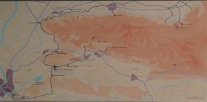
The map of the Arles aqueducts exhibited in the Arles Archaeological Museum. Photo by TimeTravelRome.
A first 51 km aqueduct (known as the Eygalières aqueduct) drew water from the northern slopes of the massif most of which flowed underground to the west following the rock face. This structure was remarkable for its extremely shallow slope, of the order of a few tens of millimeters per meter.
The “Caparon” aqueduct, a second, shorter structure (11 kms long) collected water from the Entreconque rock and followed the southern flank of the Alpilles to the west.
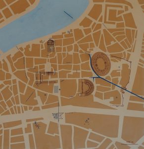
Traces of aqueducts within the city of Arles. The map from the Arles Archaeological Museum. Photo by TimeTravelRome.
The two branches meet south of today’s Fontvieille in a basin of convergence. From here, a single 325 meters-long aqueduct-bridge crossed the Vallon des Arcs, then curved westwards and entered Arles near today’s cemetery, and finally split off at the Forum. The water was then distributed to the various districts by a system of lead pipes.
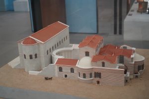
Constantine Baths in Arles – reconstruction. Photo by TimeTravelRome.
Although considerable, the aqueduct’s flow rate may not have been sufficient to supply the thermal baths, fountains and basins of the many villas. Wells and cisterns designed to collect rainwater were therefore in use throughout antiquity.
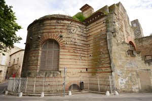
Constantine Baths in Arles today. Photo by TimeTravelRome.
Probably as early as the 2nd century, water from the southern aqueduct was diverted shortly before arriving at the Barbegal convergence basin, and flowed over a second aqueduct-bridge built parallel to the first. Taking advantage of a of almost 20 meters, the water was used as a motive force to turn the wheels of a huge milling plant: the Mills of Barbegal.
The Mills of Barbegal
So, the Barbegal aqueduct and mills was a Roman watermill complex located on the territory of the commune of Fontvieille, Bouches-du-Rhône, near the town of Arles, in southern France. The complex has been referred to as “the greatest known concentration of mechanical power in the ancient world” and the 16 overshot wheels are considered to be the largest ancient mill complex.
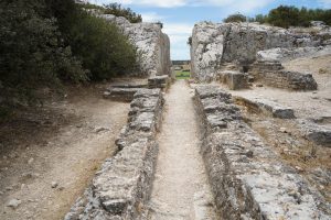
The “arrival” point at the site of Barbegal. On the right one can see the channel turning – this branch of the aqueduct led towards Arles. Photo by TimeTravelRome.
Another similar mill complex existed on the Janiculum in Rome, and there are suggestions that further such complexes existed at other major Roman sites, such as Amida (Mesopotamia)
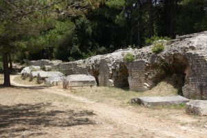
Aqueduct of Barbegal. Photo by Michel Gybels.
The Barbegal site is located 12 kilometers east northeast of Arles near Fontvieille, where the Arles aqueduct passed near a steep escarpment. The mills consisted of 16 water wheels in two parallel sets of eight descending a steep hillside. There are substantial masonry remains of the water channels and foundations of the individual mills, together with a staircase rising up the hill upon which the mills were built. The mills operated from the beginning of the 2nd century until about the end of the 3rd century.
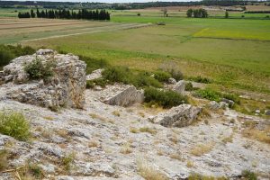
Remains of the mills complex on the slope of the hill. Photo by TimeTravelRome.
The capacity of the mills has been estimated at 4.5 tons of flour per day, enough to supply bread for as many as 10,000 of perhaps 30–40,000 inhabitants of Arelate at that time. It is thought that the wheels were overshot water wheels with the outflows driving successive wheels to the base of the hill.
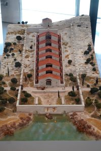
Mills of Barbegal – Reconstruction. Photo by TimeTravelRome.
Vertical water mills were well known to the Romans, being described by Vitruvius in his De architectura of 25 BC, and mentioned by Pliny the Elder in his Naturalis Historiæ of 77 AD. There are also later references to floating water mills from Byzantium and to sawmills on the river Moselle by the poet Ausonius. The use of multiple stacked sequences of reverse overshot water wheels was widespread in Roman mines, especially in Spain and Wales. It is possible that the mills at Barbegal may also have been used for sawing timber and stone when not grinding wheat. The Hierapolis sawmill from the 3rd century AD shows a crank-activated frame saw being used in this way, and another has been excavated at Ephesus.
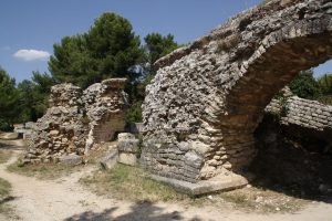
Ruins of the Barbegal Aqueduct. Photo by Michel Gybels.
Visiting the Site of Barbegal Mills
Visitors to Barbegal may park where a minor road (Route de L’Aqueduc) crosses the massive remains of the original aqueduct, and, with olive orchards on either side, walk south about 250 meters along the partially erect remains of the aqueduct and through the three meter deep rock-hewn cleft emerging at the top of the mill complex. Extensive farmland comes into view and spans 180° of the horizon to the south. The site is signposted as “Roman aqueduct” rather than as a mill. The Arles Museum of Antiquity has an informative reconstructed model of the mill – it is pictured above. The visit of the site is free.
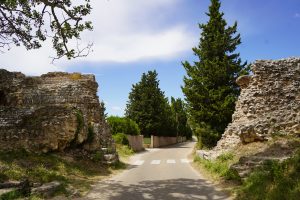
The road cutting the Barbegal aqueduct in two. Photo by TimeTravelRome.
Source of the header picture:


